IRI Maproom Climatique et de la Société

Le Maproom climatique et de la société est une collection de cartes et d'autres figures qui surveillent le climat et les conditions de la société à présenter et dans un passé récent. Les cartes et les chiffres peuvent être manipulés et sont liées aux données d'origine. Même si vous êtes principalement intéressés par les données plutôt que des chiffres, c'est un bon endroit pour voir ce qui ensembles de données sont particulièrement utiles pour la surveillance les conditions actuelles.

    Historical, current, and future climate conditions around the globe.
    Adapter l'Agriculture au Climat Aujourd'hui, pour Demain ; un Columbia World Project
    This collection of maps provides information that can be used for humanitarian decision-making around the world, developed by the IRI and the IFRC. It also provides information on the types of early action that can be taken based on these maps.
    This collection of maps provides climate forecast information on seasonal and subseasonal timescales to support decision-making by humanitarian aid agencies in the START Network
    This Map Room includes maps and analyses useful for monitoring ENSO, understanding the impacts and learning about key scientific advancements that have led to our current level of knowledge.
    Le climat affecte la santé humaine de différentes façons. Ses effets peuvent être directs, comme dans le cas d'une vague de chaleur ou indirects, comme dans le cas des maladies infectieuses telles que le paludisme et la dengue.
    Le climat peut affecter la sécurité alimentaire directement ou indirectement.
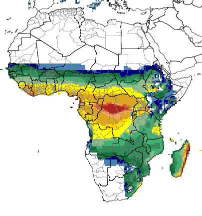
    The variability of seasonal temperature and precipitation and the sub-seasonal statistics of these and other climate variables play a key role in the quality and quantity of agricultural output. This map room includes maps and analyses of seasonal statistics of historical temperature and precipitation, seasonal temperature and precipitation forecasts, and GCM skill maps for regions of Asia and South America, and a map of farming systems in Africa.
    The Climate and Fire Map Room includes forecast and analysis tools for two regions of the world, Indonesia and the Western Amazon.
    Climate Information for Water Managers.
    Enhancing Adaptive Capacity of Andean Communities through Climate Services